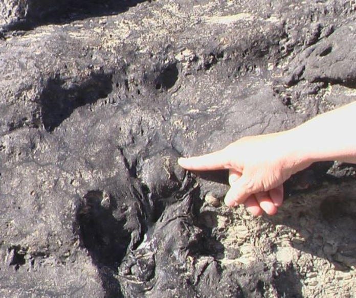
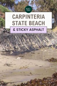
At Carpinteria State Beach in California, you may have sand on the inside of your shoes and Miocene-age asphaltum, a natural tar or pitch on the outside if you walk beyond the water’s edge.
The Carpinteria State Beach is a beautiful and often uncrowded public park about 79 miles north of Los Angeles near Ventura, on the shores of the Pacific. Tar has been oozing and dripping from Miocene-age shale, conglomerates and sandstone bluffs along the Pacific Ocean beachfront since the Pleistocene epoch.
The beach itself is mostly free of asphalt except for the low bluffs along the shore. This park is the only public beach in North America where such a phenomenon is very prominent. While other tar beaches exist in the United States, they are not open to the public. Tar seeps on beaches are uncommon worldwide and there are only five such beaches.
The material oozes out all the time. On land it hardens on cool days, leaving a rubbery black substance that becomes soft again in warm weather.
Why is There So Much Petroleum?
The answer lies in plate tectonics. Approximately 35 million years ago a complex of tectonic forces resulting from the interaction of the Pacific Plate, the Farallon Plate and the North American Plate along the San Andreas Fault system began. During the mid-Quaternary, approximately 10 to 15 million years ago, the older trenches along the prehistoric coastline disappeared and transform faults replaced them. A great many things were happening at that time, among them the opening of the Gulf of California (Baja California) because of rifting.
The entire Pacific Plate continually moves northwestward to this day. Because the crust above the Pacific Plate south of Los Angeles has difficulty turning westward as the Plate is in its northwest motion, the crust compresses and rises in sections. Faulting both onshore and offshore results and the petroleum locked within the Monterey and the Punta Gorda Formations naturally comes to the surface.
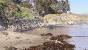
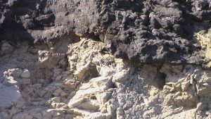
On the beach itself, the bluffs provide an interesting sight. The sticky stuff on the bluffs and out in the water can be startling and many may think it is pollution caused by humans. At Tar Pits Park and Carpinteria State Beach, crude oil creates several thin ribbons of black running parallel to the shore. You can see these ribbons clearly while driving on U.S. Route 101 near Goleta to the northwest between Gaviota and Carpinteria.
The sands at Carpinteria are the “bituminous” sands within a terrace deposit of the Monterey Formation, and at the easternmost portion of the State Beach, the terrace deposits of the Punta Gorda Formation. The Monterey Formation is shale and the Punta Gorda is sandstone and conglomerate. Visitors can see offshore oil rigs in the ocean in the far distance, extracting the crude petroleum from these two Formations.
Early Times
Natural asphalt or “asphaltum” is petroleum that has lost its gases and liquid through evaporation and leaching upon exposure to the atmosphere. The bluffs are probably the only locations where small animals like insects and snails are trapped. At Carpinteria State Beach and Tar Pits Park, fossils have been collected of Pleistocene plants representing species that are now only found in more northern locales in California. These include bishop pine, manzanita and coast live oak. This area was cooler and a bit more humid during the Pleistocene when the asphaltum deposits first became the norm along this stretch of coastline. Animals that thrived in the cooler environment included camels, giant ground sloths, bison, horses, bears, and American mastodons.
Human Inhabitants
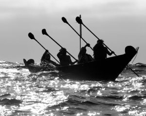
In late Pleistocene times, the first humans came to the region. The first recorded tribe is the Chumash. They are the largest group of Native Americans in the Santa Barbara area and were attracted to this beach for seafood and for the asphaltum, waterproofing their twelve-man seagoing canoes with the substance. Only the chief or others of very high rank could order the building of these canoes so vital to the people and their ability to obtain protein and to trade with others. They sometimes traveled to the Channel Islands off the coast. Their village of Mishopshnow, a trade center with over 30 orange-shaped roundhouses, was located at the mouth of Carpinteria Creek. Over a hundred people are estimated to have lived here at the time of the Spanish settlers.
The Pacific Coast Highway (St. Rt. 1) has its own interesting history. Early Spanish explorers who traveled what they called the Royal Road (now U.S. Route 101 and U.S. 1) gave the name carpenter’s or joiner’s shop (Carpinteria) to the village. The Chumash population dwindled in the village because of European contagious diseases. More changes followed with the Mexican-American War of 1846 and the purchase of much of California from Mexico by the United States.
Las Chonchas Asphalt Mine
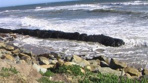
The California Petroleum and Asphalt Company built the Las Conchas Asphalt Mine complete with a refinery and employee housing on the beach in 1891. Big tanks of boiling water separated the asphalt from the sand. A black asphalt-covered cement ring used for a tank support and a timber retaining wall are still present in the breaker zone. Remnants of the refinery equipment are visible in the sand.
A railroad spur was built close to the beach bluffs. Asphaltum went by railroad or ship to the markets where it was made into street paving material, varnishes and charcoal briquettes. In modern times, the manufacturers of charcoal briquettes used to grill food have replaced asphalt with sodium nitrate and have added safer carbons and waxes.
Singing & Dancing on the Shore
After the mine closed in the 1920s, tourists trespassed and camped on the beach. The nearby town of Carpinteria purchased the land and built a park to make it legal and to collect tourist money. The tourists came in droves and initially showed their lack of concern for others by leaving mass quantities of trash. The town cleaned up the beach and the Cerca del Mar Clubhouse was built. It was intended for a wealthy clientele, serving one-dollar dinners. The resort clubhouse was closed in the early 1930s with the Great Depression. It sat vacant until the State of California and Santa Barbara County bought it during the World War II years to provide a place for Army soldiers suffering from battle fatigue. The State of California converted this land to a state beach and there’s no trace of the Clubhouse now.
No Rip Tides Here
Carpinteria State Beach is safer than other beaches in the area because it lacks rip tides. It is only 59 acres in total area but in its 59 acres are campsites, including a bike-hike campsite and natural tide pools with anemones and crabs. Surfing is good here. The water is warm almost all year and the air temperatures are pleasant winter or summer. In the winter it is usually no less than 58°F. In summer, the area usually does not get hotter than 90°F.
There is also a “wet meadow” wetland to view in the northern portion of the park. Children have plenty to do. The Tomol Interpretive Play Area in the northwest portion of the State Beach next to “The Spot,” a small restaurant, provides a playground for younger children.
Visitor Information
Carpinteria State Beach is open year-round. There is water, electric and sewer for campers in select locations. Most campsites have some shady trees. The camp sections are San Miguel, Santa Cruz, Anacapa and Santa Rosa. San Miguel has electric and water hookups only. The Santa Rosa section has showers. The state charges a small fee per car entrance fee.
The park is easily reached by car at 5361 Sixth Street, Carpinteria. AMTRAK also serves the park and stops at 5th Street. There are stores and bike rentals in the small city.
Sticky Shoes
Asphaltum will come off tennis shoes or sandals by scraping with a butter knife or disposable plastic knife. Ice makes the tar hard and easier to scrape. Apply baby oil or coconut oil and dab the stain. After that, use a scrub brush and dishwashing detergent mixed with water. Leather shoes should be left in the camper or car and not worn here.
Tar Pits Park
Worthy of mention is Tar Pits Park. It is a tiny city park just to the south of Carpinteria. It is a bluff overlooking the ocean and can be reached on foot from Carpinteria State Beach using a flight of steps. It is even less crowded than the State Beach.
This story about Carpinteria State Beach previously appeared in Rock & Gem magazine. Click here to subscribe. Story and pictures by Deborah Painter.


